To estimate the height of the top of cumuliform clouds using satellite images it is necessary to have..
Visual Images. Although visual photography may be easy to interpret, it suffers the disadvantage of not being available continuously, due to lack of sunlight at night. Clouds will appear white, the land grey and the sea black
Infrared (IR). Infrared images have the advantage of being available for 24 hours a day and the shading of the picture will be more or less the same by day and by night. Cold (high) cloud will give a white image, lower cloud a somewhat darker one, whilst warm land will give a dark image.
To get a clear picture of the weather you should analyse both the IR and visible images.
- If both images are bright in the same area => very likely that you can find a very high and thick cloud with high convective activity over that area.
- If you get cloud returns on a visible imagery but not on an IR image => most likely a low cloud
Your Notes (not visible to others)
This question has appeared on the real examination, you can find the related countries below.


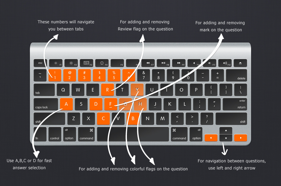
Use your keyboard for faster navigation